-
 files/S1f18db3080f142bfb310af6cbe9fd255B.webp
-
 files/S7a347dba34f44350bf661aed6400b84ce.webp
-
 files/Se06c2788b52347eeabd20c10f0e0cdc7s.webp
-
 files/S421d14a975fb427dbd036d33b6133423L.webp
-
 files/S7cfdd8a6155e4dc2bb4ec1d3f2cfa139G.webp
-
 files/S396e98bfb6af45628ab6b6405e19b0a3w.webp


S8 Mini Portable Handheld GNSS Land Surveyor Meter
- Regular price
- €156,99
- Regular price
- €156,99


Product Description
S8 Mini Portable Handheld GNSS Land Surveyor Meter – High-Precision Area Calculator with Real-Time Trail Display and Active Navigation
🌾 📐 🧭 The Compact, Multi-Functional Field Mapping Hub That Does It All
Meet the S8 Mini Portable Handheld Land Surveyor Meter—a feature-packed, high-precision instrument engineered specifically for agricultural surveyors, forestry agents, construction workers, and land management professionals.
Combining an ultra-fast GNSS positioning engine with a rugged pocket-sized design and a 2.4-inch outdoor-optimized screen, this instrument calculates exact farmland acreage, tracks linear boundaries, and manages complex routes. Unlike passive data loggers, the S8 delivers true active waypoint navigation alongside real-time trail rendering to keep you fully oriented across tough terrain.
🛰️ Fast-Lock GNSS Tracking & High Spatial Accuracy
-
Lightning-Fast Signal Acquisition: Equipped with a rapid-lock receiver featuring a 1-second hot start time and a 30-second cold start window.
-
Tight Position Alignment: Delivers a horizontal positioning accuracy within 2 meters under optimal satellite locks (when HDOP values drop below 1.0).
-
Highly Accurate Linear Logs: Tracks straightforward distances to within one meter over a standard 100-meter range.
-
User-Defined Precision Thresholds: Features a customizable, user-defined HDOP safety filter setting to ensure you only log data when satellite geometry meets your standards.
🗺️ Full Navigation Suite, Route Editing & Real-Time Trail Mapping
-
True Standalone Navigation: Features full navigation support and waypoint navigation to guide you precisely to pre-marked boundaries or remote corners.
-
Advanced Route & Trail Editing: Supports comprehensive route editing and trail recording, allowing you to build and store up to 200 routes with up to 400 distinct points per route.
-
Live On-Screen Trail Display: Renders a real-time trail display as you walk or drive, giving you an immediate visual map of your boundary progress.
-
Dual Barometric & GPS Altitude: Uses an internal barometer to measure elevation changes with a sharp 1-meter relative accuracy, backed by a secondary 10-meter GPS elevation layout. (Note: Absolute barometric height requires a simple calibration upon startup).
📊 Comprehensive On-Board Data Statistics & Memory Architecture
-
Advanced Data Processing: Includes dedicated area and distance statistics modules to calculate field dimensions instantly.
-
Extensive Internal Memory Storage: Keeps your crucial field logs safe and accessible with an expansive internal database layout:
-
Area Logging: 99 dedicated area history blocks alongside 2,000 waypoint records.
-
Distance Logging: 99 distance statistics logs paired with 100 complete trail records.
-
-
Quick Historical Reviews: Browse and view past measurement data right on the screen using the integrated statistics records menu.
🔋 All-Weather Field Reliability & Universal USB Connectivity
-
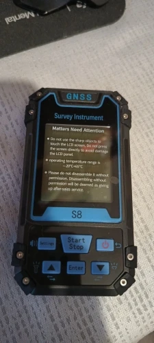
Outdoor-Optimized 2.4" Display: Uses a 2.4-inch outdoor high-definition black-and-white display that remains perfectly clear under direct afternoon sun.
-
Seamless USB Data Export: Outfitted with an on-board USB data interface for fast data export, which also serves as the main charging port.
-
Harsh-Climate Resilience: Engineered to withstand demanding environments, operating flawlessly across a temperature range of -20°C to 65°C.
-
1800mAh Rechargeable Battery Core: Powered by a removable 3.7V lithium-ion 1800mAh cell. (Please note: The master shipping configuration contains no standalone external battery packs, and the cell charges directly inside the device frame).
⚙️ Product Specifications
-
Brand Name: NONE
-
Model Configuration: S8 Pocket Land Surveyor Meter
-
Item Type / Class: GNSS Handheld Land Meter Measuring Instrument
-
Display Properties: 2.4-Inch Outdoor High-Definition Black & White Screen
-
Location Acquisition Speed: Hot Start: 1 Second | Cold Start: 30 Seconds
-
Horizontal Position Accuracy: Within 2 meters (HDOP < 1.0)
-
Distance Tracking Accuracy: Within 1 meter (HDOP < 1.0 over a 100-meter range)
-
Area Calculation Variance: Error limits within 0.03μm ($1\text{--}3\mu\text{m}$) | $2\%$ error limits on plots greater than $3\mu\text{m}$
-
Elevation Tracking Core: Dual Mode: Barometric ($\approx 1\text{m}$ accuracy) / GPS ($\approx 10\text{m}$ accuracy)
-
Core Measurement Arrays: Coordinate Measurement, Route Editing, Trail Recording, Elevation, Navigation, Height, Distance, and Area Measurement
-
Data Capacity Limits: 200 Routes (Max 400 Waypoints Each) | 2,000 Standalone Waypoints | 100 Trails
-
Data Handling Interfaces: USB Interface / Supports Secure Data Export
-
Environmental Limits: Operating: -20°C to 65°C | Storage: -40°C to 75°C
-
Battery Specification: 1 × 3.7V Li-Ion 1800mAh Battery Cell
-
DIY & Trades Classification: Electrical Supplies
-
Origin: Mainland China
🕹️ Quick-Start Field Calibration Guide
1. First-Time Satellite Synchronization
For maximum tracking precision, walk into an open field away from tall buildings or dense trees when first powering the S8 on. This ensures the unit achieves a strong satellite lock and reaches an HDOP value below 1.0 for high-accuracy tracking.
2. Calibrating Elevation Altitudes
To use the barometric height measurement feature, navigate to the altitude settings menu at your starting point. Calibrate the barometer against a known local altitude reference point to lock in absolute height calculations.
3. Route & Waypoint Exporting
Connect the S8 directly to your terminal via the data-sync USB interface. Open the device directory to safely export your saved area logs, waypoint maps, or trail records for backup.
📦 What’s Included
-
1 × S8 Mini Portable Handheld Land Meter Unit
-
1 × Internal 3.7V 1800mAh Rechargeable Lithium-Ion Battery
-
1 × High-Speed USB Charging & Data-Sync Cable
-
1 × Quick-Start Equipment Instruction & Operations Manual
🛒 Pocket-Sized Precision. Active Field Navigation.
The S8 Handheld GNSS Land Surveyor Meter is the ideal tool for agricultural contractors mapping out crop fields, woodland conservationists recording trail boundaries, and land auditors demanding pocket-sized data precision.
Customer Reviews
Customer Reviews
Excellent, good quality materials, just need to know how to use it.